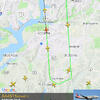
When I first started to investigate the airport noise problems in southern Maryland, I did not know anything about the north landing at DCA. We have problems with NextGen that are unique. For the north landing, ATC at DCA direct airplane to fly due south of DCA as far as La Plata Maryland. the aircraft then make a 180 turn and fly to DCA. I have counted as many as nine aircraft lined up to land at DCA.
The aircraft uses GPS signals and electronics on each aircraft to broadcast their position Each aircraft and the ATC knows where each plane is at any given moment. Using this technology, the DCA ATC can bring in each aircraft to land at DCA one after the other. This process reduces the amount of time it would have taken to bring in aircraft in a given period. From my research, the process is somewhat automatic and requires less control from human air traffic controllers.
The FAA prefers the north landing due to fewer resources required. I believe another reason they favor the north landing approximately 80% of the time is they get less complains from residences and politicians. Look at the image I posted at the end of this post. The FAA could set up the north landing route in many different points on the map. I believe they selected this area due to their belief they would get the lest opposition here. There are three Web sites you should visit to understand NextGen.
Join our Facebook Page
-------------------------------------------------------------------------
Visit our companion listserv for information
-------------------------------------------------------------------------
Southern Maryland Fair Skies Coalition
http://www.somdfairskies.com/
-------------------------------------------------------------------------


Comments
The problems with airport noise are not isolated to our communities. These problems exist in at least 21 communities. Many of these communities are putting up a more effective fight against the FAA than we are.
Check out this website. On this website, you will find information on the history of NextGen, legal decisions, and methods to Challenge FAA decisions.
“Airport Noise Law"
"Airport noise cannot be stopped, short of closing down an airport. But it can be mitigated. Getting to that point is an extremely complex process that has ground down many citizens who ultimately decided to "get a life" away from endless meetings with airport and FAA officials. Suing the airport for monetary damages may offer sweet revenge to some — and perhaps make noise more expensive to the airport — but it's not likely to make your community more livable...... ..What to do? You alone cannot attack airport noise -- not even with the help of your next-door neighbor. You and your community will get nowhere in mitigating airport noise to a livable level until you organize on a massive scale. If airport noise bothers only a handful of people in your community, forget it — move out. But if the lives of a significant segment of your community are disrupted by aircraft noise, you've got the potential power to do something."
AirportNoiseLaw.org
National Transportation Noise Map
https://maps.bts.dot.gov/arcgis/apps/webappviewer/index.html?id=a303ff5924c9474790464cc0e9d5c9fb
Road and Aviation Noise in the United States
The noise map facilitates the tracking of trends in transportation-related noise, by mode, and collectively for multiple transportation modes. The data allow viewing the national picture of potential exposure to aviation and highway noise. The data also allow viewing of the potential exposure at the state or county level.
The National Transportation Noise Map is an addition to the National Transportation Atlas Database (NTAD), a set of nationwide geographic databases of transportation facilities, networks, and associated infrastructure available from the BTS Geospatial Data Catalog. The layers will be updated on an annual basis, and future versions of the National Transportation Noise Map are envisioned to include additional transportation noise sources, such as rail and maritime.
The BTS map contains aircraft and road noise inventory data provided as web map services (WMS) for use with Geographic Information Systems (GIS), computer programs that can store, analyze, and present spatial or geographic data.
Source:
Sources: U.S. Department of Transportation, Bureau of Transportation Statistics, National Transportation Noise Map; U.S. Census Bureau, 2014 American Community Survey 5-year Estimates; National Institute on Deafness and Other Communication Disorders, I Love What I Hear! Common Sounds , available at :https://www.nidcd.nih.gov/health/i-love-what-i-hear-common-sounds
This national, multimodal transportation noise mapping initiative used data sources from the Federal Aviation Administration (FAA) and Federal Highway Administration (FHWA) to create a comprehensive map of noise levels.
D.C.’s attorney general has asked the Federal Aviation Administration to make changes to its policy on aircraft noise near airports, saying the agency uses inadequate and outdated information to set its rules.
Attorney General Karl Racine also said the FAA didn’t apply its noise policy consistently and fairly when rerouting flights to and from Reagan National Airport in 2015, leading to an increase in noise near the airport."
https://wtop.com/dc/2021/03/dc-attorney-general-urges-faa-to-change-airport-noise-policy/